I’m only really just starting to realise how many places there are in and around Adelaide to go for a nice walk or a hike. The beach and esplanade are always popular, and the Waterfall Gully hike to Mt Lofty is a well-known and popular hike. However, the hills that surround Adelaide are full of hiking options that allow you to step away from suburbia and into nature.
Morialta Conservation Park, located just 10km from the city, is nestled at the foot of the Adelaide Hills and is full of walking trails ranging from easy to more difficult.
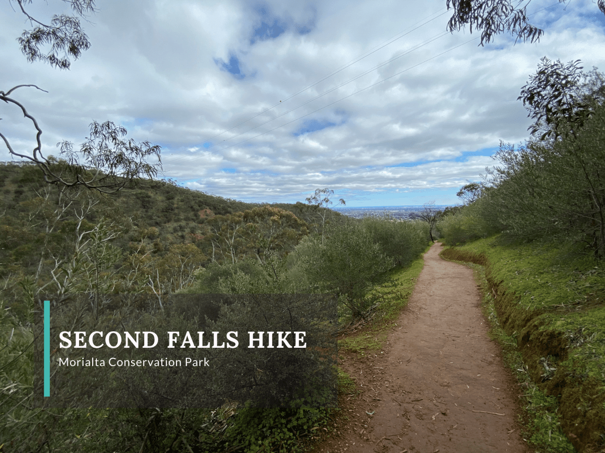
Second Falls Gorge Hike
The Second Falls Gorge Hike is a great moderate loop hike that takes in plenty of bushland, two waterfalls and stunning views. The trail is well signposted throughout and at all points where other trails cross or merge with it.
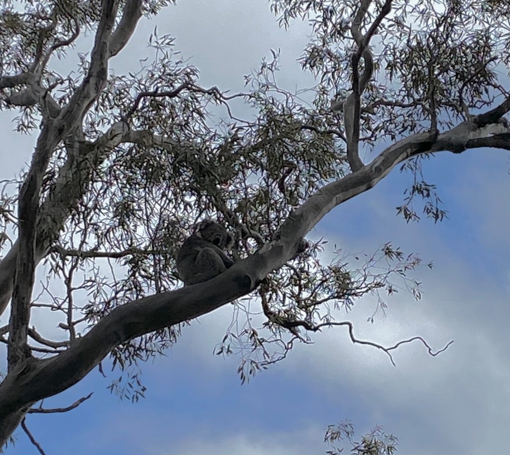
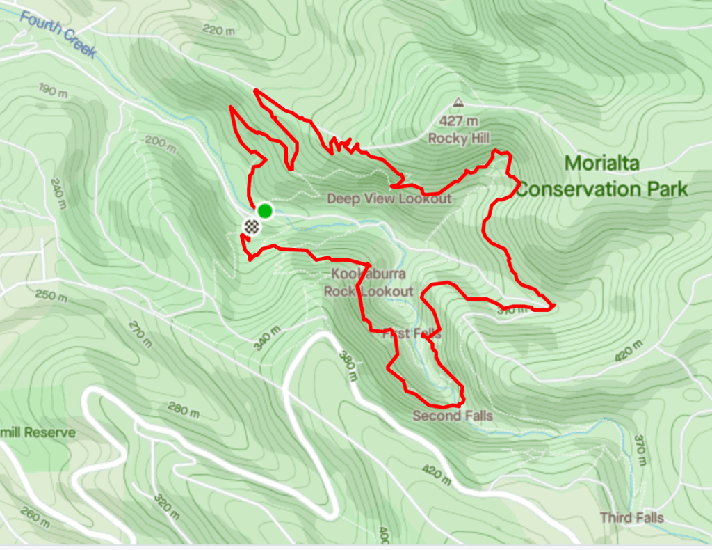
The 5.3km walk starts with three other trails from the car park. Walking clockwise, the trail rises fairly quickly through the low bush and gum trees before opening up onto a wide track with great views of the city and ocean beyond. This part of the path was where we spotted the most wildlife, including several birds and a koala sleeping high up in a tree.
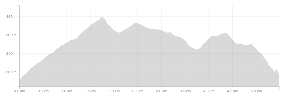
Next, the trail takes several switchbacks to its highest point at 350m before dropping slightly to the Deep View Lookout. From there, the trail rises and falls to two more peaks as you slowly make your way downwards and around the gorge. The views are excellent, and the bush changes slightly at the higher elevations of the trail with less green undergrowth and more native plant life.
Walking clockwise, it takes more than 3.5km before you get your first view of the falls. First Falls (or Morialta Falls) can be seen from the lookout dropping off the edge of the rocky cliff in the distance. At the edge of the Falls’ pond, there is also a lookout on the valley floor. There is another short climb on the way to the Second Falls lookout, but before getting there you are treated to city-less views of the gorge. Until First Falls, the views through the valley all frame the city in the background, but as you continue towards Second Falls the valley views close in showing just the zig-zag of the foothills.

You actually hear Second Falls before you see it. Considering that it has been a drier than average winter, it was surprising how much water was cascading down the cliffside. There are good lookout points around Second Falls, and there is a small bridge as the trail crosses over the waterflow headed towards the cliff.
From Second Falls, the trail takes a quick kilometre downwards path towards the car park, with another lookout towards Second Falls about halfway down.
Walk Details
Distance
5.3km
Duration
1 hr 45 min
Difficulty
Easy to Moderate
Elevation Gain
170m
Map
Park map can be found on Morialta Conservation Park‘s website.
The Essentials
Getting There
Morialta Conservation Park is located 10km north east of Adelaide. From the city head east towards the hills on Magill Road to Norton Summit Road. Turn onto Glen Stuart Road, then right onto Morialta Road before coming to Morialta Falls Road.
There is an Adelaide Metro bus stop at the entry to the conservation park.
The Trailhead
The Trailhead is just over a kilometre from the park entry on Morialta Road. It has parking, toilets, benches, and information signs. There is additional parking and BBQs closer to the park’s entry.

One reply on “Hike at Morialta Conservation Park”
That’s a cute Koala!
LikeLiked by 1 person