Nestled in the hills between the vineyards of the McLaren Vale wine region and the southern Adelaide suburbs of Morphett Vale and Hackham, the Onkaparinga River National Park is home to the stunning Onkaparinga Gorge, a variety of native vegetation and wildlife, a rock climbing zone and a campground.
There are about a dozen walking and shared-use trails in the park, which are easily accessible from one of its several parking areas. The majority of the trails and points of interest are located in the park’s eastern end, where a lot of work has gone into revegetating the area.
The area was grazing and farm land for European settlers between the late 1840s until 1982, when the land was transferred to the Department of Environment. The traditional owners of the land are the Kaurna people.
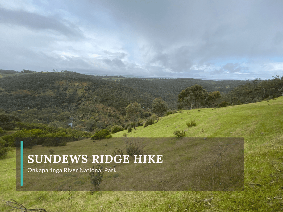
Today, a variety of gum trees populate the area, and sundews and native orchids can be found in the park. The vegetation can be seen on the Sundews Ridge and Lookout Hikes, as can spectacular views of the Onkaparinga Gorge and surrounding vineyards.
Sundews Trails
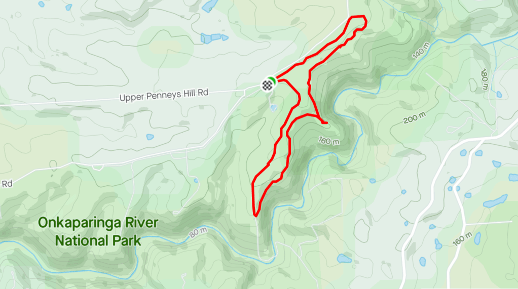
The Sundews Ridge and Lookout Hikes can be accessed from Gate 11, located on Piggott Range Road. The Sundews Trailhead, located at Gate 11, has a paved parking area, toilet and signage. From the trailhead, the Sundews Ridge and Lookout Hikes follow the same path to the gorge lookout.
The path is wide at first and surrounded by bushland as it quickly departs from the road. After a few minutes the Sundews paths turn off into a well-worn and signposted singletrack that takes a fairly straight path towards the lookout.
The lookout over the Onkaparinga Gorge has wide views of the valley and river below and the rocky ridgeline of the rock climbing zone can be seen in the distance.
From the lookout, the trails diverge. The Gorge Hike descends steeply into the valley and is more difficult than the other two trails. The Sundews Lookout Hike loops back to the car park, while the Sundews Ridge Hike takes a longer loop along the ridge before returning.
The Sundews Ridge Hike continues on single-track with a few relatively steep but short declines before the path emerges from the bush along the grassy ridge. From here, there are more sweeping views of the surrounding valley. The trail then heads back into the trees and towards the car park. On the way, it crosses the wider Gorge track, which is a vehicle track back to the car park.
There is a small meadow on the side of the Gorge Hike vehicle track between the intersection with the Sundews Ridge Hike and the car park. Here, lucky walkers might spot kangaroos or a few loose sheep.
Walk Details
Distance
5.5km (Sundews Ridge Hike, returning via Gorge Hike)
Duration
1hr 20 min
Difficulty
Moderately Easy
Elevation Gain
131 m
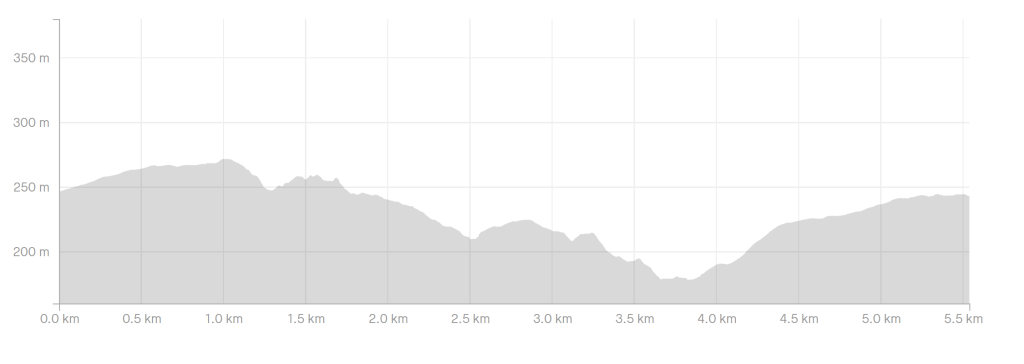
Steepest Climb
12%
Map
The park map can be found on the Parks SA page for Onkaparinga River National Park.
The Essentials
Getting There
The park is located 35km south of Adelaide, with most of the trails on the northern side, along Piggot Range Road. To reach Gate 11 / Sundews Trails car park, drive south on Main South Road (or take the Southern Expressway to the Reynella Exit) to get to States Road.
From States Road, take Upper Penneys Hill Road which will T-junction at Piggott Range Road. The car park will be about 100m to the left.
The Trailhead
The Sundews Trails Trailhead is to the left of the carpark. There is one toilet at the car park.
