There are surprising pockets of nature and bushland all over the Adelaide metropolitan area. As the metro area creeps towards the Adelaide Hills, the flat land gives way to increasingly steep undulations, gorges and land difficult to build on. It’s in these places that I am learning to find some great, less-trafficked spaces for outdoor activity and a little bit of adventure close to home.
After being stuck inside for weeks due to a short lockdown and an unusual amount of rain, we took advantage of a beautifully sunny Saturday afternoon try a new hike. This was how I discovered the Sturt Gorge Recreation Park, a 400-hectare hidden gem with excellent scenery, a beautiful river, and some moderately difficult hiking to enjoy.
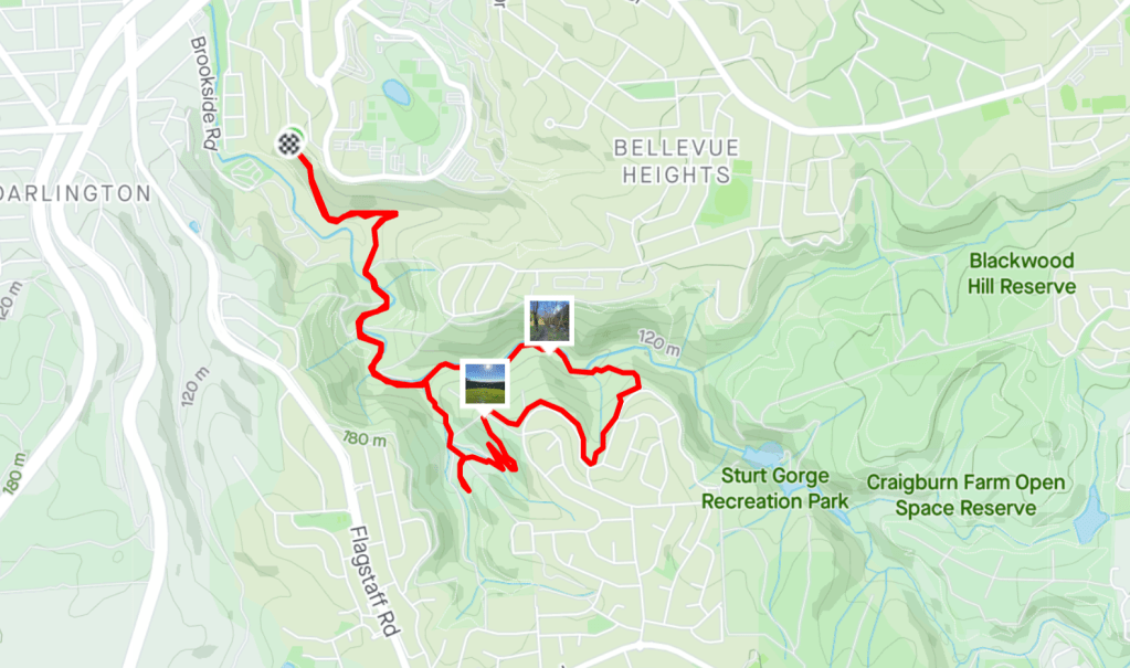
Sturt Gorge Recreation Park
Wedged between suburban streets 13km south of the city, Sturt Gorge Recreation Park has more than two dozen trails that traverse the Sturt River, take in expansive views over the gorge and valley, and pass by a rock formation known as sturt tillite. The park has a combination of shared-use paths and walking-only trails, so it is popular with mountain bikers, dog walkers and hikers.
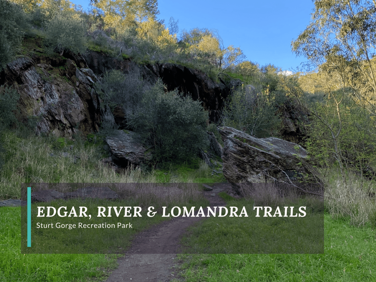
A moderate and interesting introduction to the park is a combination of the Edgar, River and Lomandra Trails. The 7-kilometre hike is part out-and-back, part loop trail that is accessed from the end of Edgar Street in Bedford Park.
Edgar Trail
Edgar Trail is a vehicle maintenance path that cuts from the end of the street across the hillside towards the official recreation park, where it meets up with the River Trail. At first, the views are across the valley and a slightly industrialised area, but as the trail descends it get narrower and becomes increasingly surrounded by trees. A few minutes after reaching the bottom, we got our first views of the river which was moving quickly.
When Edgar Trail enters the recreation park the narrow path opens up as several paths cross each other and the river. There is an information sign in the open area; however, we were using the AllTrails app for the first time and had good mobile coverage, so we didn’t stop to look at the signage.
River Trail
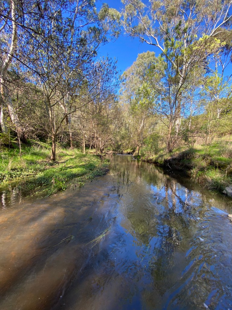
There are cement blocks that act as stepping stones to cross the river, so we were able to keep dry. However, it was really apparent from this view of the river that it was much higher than normal. It was pushing up into the grasses on the banks and moving more rapidly than I’ve seen a river flow in South Australia in quite some time. Hubby, who grew up in the area, said that he’d never seen so much water in the Sturt River before. South Australia can get so hot and dry in the summer that as frustrating as the rain has been recently, it was nice to see so much moving water and green flora thriving around the river.
The path follows the river and is meant to cross over at least twice more. However, there were no cement stepping stones at the next crossing (or the river was too high). While we did see one woman taking off her shoes to wade across with her dog, we chose to traverse the rocky side of the river to meet up with the trail we could see further along our side of the river.
From there the path followed the river and was marked. We saw some ducks furiously paddling against the current and heard frogs croaking along the banks. The river cuts deep in the gorge and its banks are shaded by trees and covered with grasses.
In a few sections we needed to traverse over rocks on the side of the river as the hill cut straight into the river bed. In drier times it probably would have been much easier.
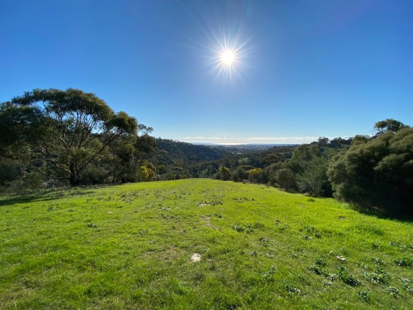
In a small clearing, the River Trail forks with the Parrianna Link Trail. The Parrianna Link Trail follows the river for about 200 metres before heading sharply uphill. From here, there are great views back down into the valley over the gums.
Lomandra Trail
At the top of the Parrianna Link Trail, the loop picks up the Lomandra Trail, which travels along the upper boundary of the park. It has excellent views through the valley to the ocean in the distance. However, the upper part of the trail is often open to the homes on the street above, so it feels much more suburban than along the river.
Lomandra Trail is a shared use trail and there were several mountain bikers enjoying the trail while we were walking. It is important to remember to pay attention to your surroundings and step off the trail if a cyclist or runner is coming up behind you.
The trail is intersected by several wide fire break tracks, one of which we took back down into the valley to pick up the Spring Creek Trail. The fire track was reasonably steep, but wide and grassy, so it was fairly easy to walk down. Spring Creek Trail was a narrow single-track that cut along a creek full of frogs and returned us to the River Trail on our way back to the start.
I was thrilled with the discovery of this park and can’t wait to check out some of its other hidden treasures.
Walk Details
Distance
7.5km
Duration
1 hour 50 minutes
Difficulty
Moderate
Elevation Gain
234m
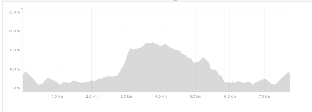
Steepest Climb
29%
Map
Park map can be found on Parks SA page for Sturt Gorge Recreation Park.
The Essentials
Getting There
Sturt Gorge Recreation Park is located 13km south of Adelaide’s city centre. It sits between the suburbs of Bedford Park, Bellevue Heights, Blackwood and Flagstaff Hill. Flagstaff Hill Road is the nearest major road.
There is no official parking area for the park, it is completely surrounded by residential streets. However, there are several areas to access the park by foot.
To get to Edgar Street, turn onto Riverside Drive from Main South Road (near the McDonald’s in Darlington). Then it is a left onto Malcolm Street and right onto Edgar Street. These are narrow residential roads, so take care when driving and parking.
The Trailhead
Entry to the park is by foot, with a number of pedestrian access points along the perimeter. Signage is available in several areas including the start of the Tilite Track on Bonneyview Road (off the up track of Flagstaff Hill Road) or Broadmeadow Drive in Flagstaff Hill.
Facilities
There are no facilities in the park. Mobile coverage was good.

One reply on “River Trail and Lomandra Trail Combined Hike at Sturt Gorge Recreation Park”
[…] other trails and can be combined to make shorter or round-trip hikes. The combination of Edgar, River and Lomandra Trails is a 7km loop that takes in the western portion of the […]
LikeLike