The Sturt Gorge Recreation Park is full of surprises, like a large dam hiding in the middle of the park.
Tucked in the southern foothills, 13km south of Adelaide, the Sturt Gorge Recreation Park has more than two dozen shared-use trails that traverse the Sturt River and criss-cross the tight valley that it flows through.
The River Trail follows the length of the Sturt River from the park’s eastern to western edges; it’s 8km in one direction and with some steep sections is considered a hard hike. The River Trail links up with several other trails and can be combined to make shorter or round-trip hikes. The combination of Edgar, River and Lomandra Trails is a 7km loop that takes in the western portion of the river.
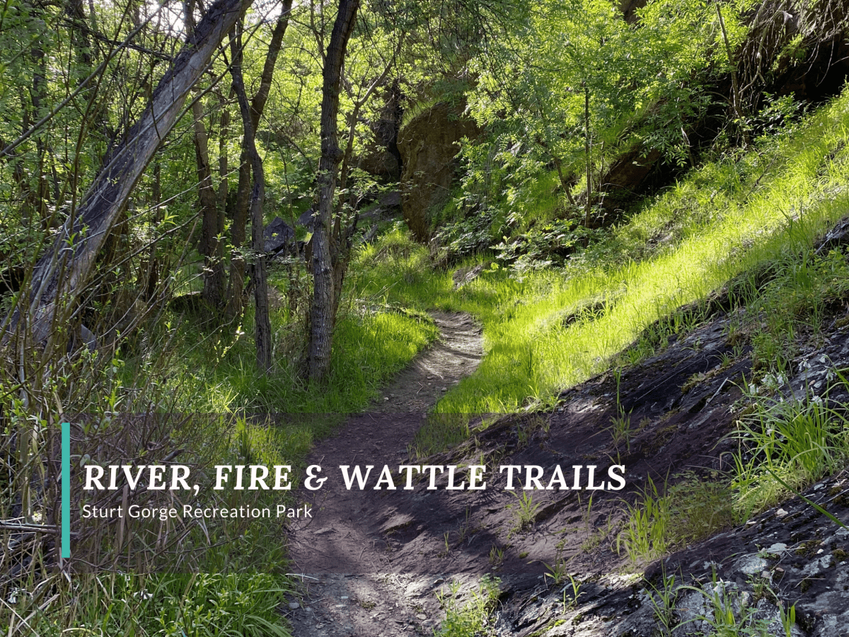
River, Fire and Wattle Trail Loop
The River, Marri Fire Track, Wattle and Lomandra Trails is another 7km loop, which picks up the central part of the River Trail. This second loop is more difficult than the first and picks up where the first one leaves the River Trail.
River Trail
The access to the start of this loop is from a small gravel parking area on Broadmeadow Drive at the top of the Parrianna Link Trail. There is an information sign at the parking area. The Parrianna Link Trail declines quickly to the southern side of the river, where it picks up the River Trail from previous loop (which leaves the River Trail to go up the Parrianna Link Trail).
The hike follows the river to the east on single-track trail. The trail cuts across the river several times at dedicated sections passable over stepping stones. Just over a kilometre along the loop, the River Trail temporarily joins the Magpie Creek Trail as it climbs sharply up the northern side of the river. Before joining the Magpie Creek Trail and climbing, the path forks, with an option to take an unnamed lower trail to the dam.
The Magpie Creek Trail climbs up steps worn into the hillside and crosses the small creek. At the top, the River Trail diverges back into its own path along the ridge. Here, it looks down on the river rather than following along its banks and temporarily becomes a shared path with mountain bikers. The upper part of the River Trail passes through meadows and different flora than along the riverbank. Walkers are also rewarded with their first views of the dam.
Sturt River Flood Control Dam
It feels like the Sturt River Flood Control Dam is hiding in the gorge. The ravine is tight and the dam is only visible from certain angles, so it springs itself on hikers previously unaware that it’s wedged into the tight canyon at the centre of the park. About 2 kilometres into the hiking loop, there is a fork with a fire track that leads to the top of the dam wall.
Following the fire track adds on a few hundred metres to the loop, but it ends at the dam, where it is possible to walk along a third of the top part of the wall. From this vantage point, hikers can see over both sides: down to the tight ravine swallowing up the controlled flow of the Sturt River on the east side, and across the low-lying lake and surrounding valley that opens up on the west side.
Back on the River Trail, the path swings wide around the lake before cutting back to the south. The dam remains visible for most of this section, having already revealed itself. The trail drops quickly down to the section of the Sturt River that feeds into the lake. As it does, the flora change becomes visibly obvious, with greener trees growing at the deepest, narrowest section of the valley closely following the river.
Wattle and Lomandra Trails
Just after crossing the river the trail rises sharply once more past gum trees. The 7km loop cuts across an open meadow via the Marri Track before meeting up with Wattle Trail. The Wattle Trail wiggles along the edge of the park, slowly declining from the loop’s highest point and providing the occasional view back to the dam, now from the south side of the lake.
Where the trail meets up turns into the Lomandra Trail, there is also an opportunity to take another steep fire track to the dam wall. From there, the Lomandra Trail runs parallel to the park border and Broadmeadow Drive. The road is visible on the left side, while the park and Sturt Gorge stretch out on the right. This section of the loop is fairly short as it finishes the return to the car park.
Walk Details
Distance
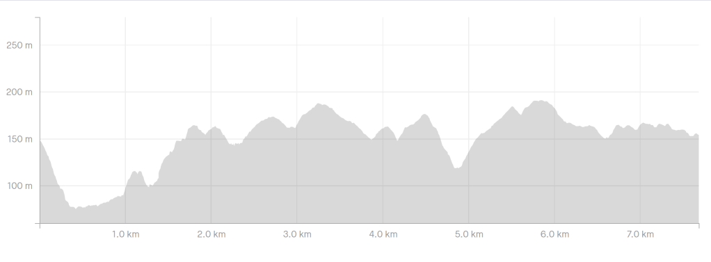
7.7km
Duration
1 hour 50 minutes
Difficulty
Moderate to Hard
Elevation Gain
234m
Steepest Climb
34%
Map
Park map can be found on Parks SA page for Sturt Gorge Recreation Park.

The Essentials
Getting There
Sturt Gorge Recreation Park is located 13km south of Adelaide’s city centre. It sits between the suburbs of Bedford Park, Bellevue Heights, Blackwood and Flagstaff Hill. Flagstaff Hill Road is the nearest major road.
While there is no official parking area for the park because it is completely surrounded by residential streets, there are several areas to access the park by foot and a small off-street gravel car park on Broadmeadow Drive.
To get to Broadmeadow Drive, take Flagstaff Road up the hill from Main South Road. Turn left onto Black Road and left onto Glenalvon Drive. At the T-Junction turn left onto Vincent Boulevard, which ends at Broadmeadow Drive. A left turn on Broadmeadow will take you to the top of Vincent Track, while a right will loop around to the top of Parrianna Track.
The Trailhead
There is a small gravel, off-street parking area at the top of Parrianna Track. Signage is located at the parking area.
Facilities
There are no facilities in the park. Mobile coverage was good.
